Comune di Macerata
Piazza Libertà, 3 – 0733 2561
www.comune.macerata.it
comune.macerata@legalmail.it
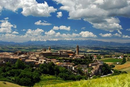
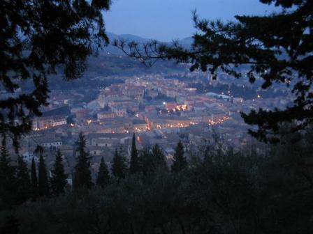
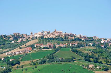
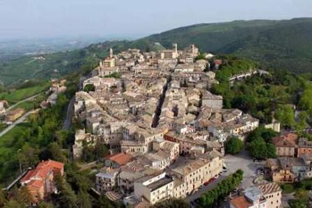
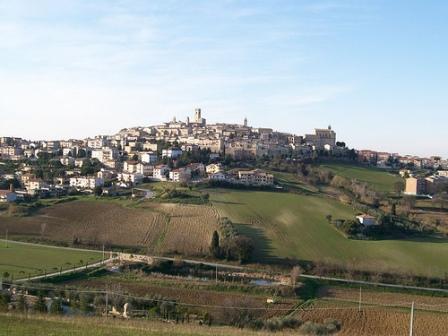
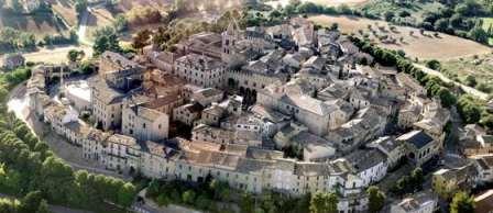
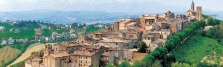
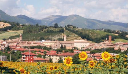
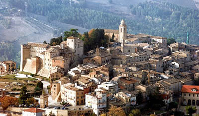
Located 314 m of alt . on a hill of the ridge that rises between the valleys of Potenza and Chienti .
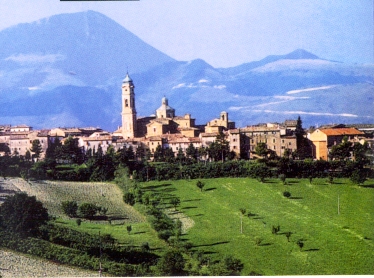
Home to universities and graduate school of the Air Force. The city’s economy is based on the marketing of agricultural products of the surrounding area , constituting the most important cereals market in central Italy , with some weight also with regard to the cattle . Industrial development is recent, but already has a lot of companies active in the construction, mechanics, food and furniture . There are significant cultural and folkloric shows in September Macerata .
Heritage preserved over the centuries :
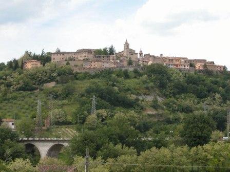
The city retains part of the walls of the fourteenth century . , Door Montana , the church of Santa Maria della Porta, with the lower church of the eleventh century . , And Fonte Maggiore, aRTEmagicC_macerata360.jpg five arches in the center of 1326. nothing remarkable among the surviving monuments of the fifteenth century . , while the first five is testified by the elegant Loggia dei Mercanti, the remodeled Palazzo Maggiore (prefecture) , Torre Maggiore, and mid-century architecture , of Bramantesque , St. Mary the Virgin , Galeazzo da Carpi , a Greek cross inscribed in a square with a high dome.
Of buckets. XVI-XVII are also some remarkable buildings : Irons , Hubs , Carradori , Lazzarini , Consalvi , the last two attributed to Tibaldi. The seventeenth century is evidenced by the church of San Giovanni and that of St. Paul, both of Barnabite Rosato Rosati, and from the town hall ( rebuilt in 1820 ) .
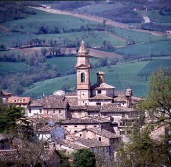
Intense architectural activity eighteenth century :
the church of St. George and the cathedral , both of Cosimo Morelli, the theater ( Bibienas – Morelli ) , and the palaces Santafiora Bonaccorsi , nor should we forget the small basilica of RTEmagicC_sferisterio – macerata.jpgMadonna of Mercy, wedged between newer buildings , dating 1497 but completely rebuilt with balanced refinement, interior and facade , by Luigi Vanvitelli (1742 ) .
The nineteenth century . boasts the sferisterio Irenaeus Aleandri , perhaps the most famous neo-classical realization of central Italy. In the former Jesuit college home to the Library, the Museum and the Municipal Art Gallery (paintings by Allegretto Nuzi , Crivelli , Girolamo di Giovanni da Camerino , Pulzone ) .

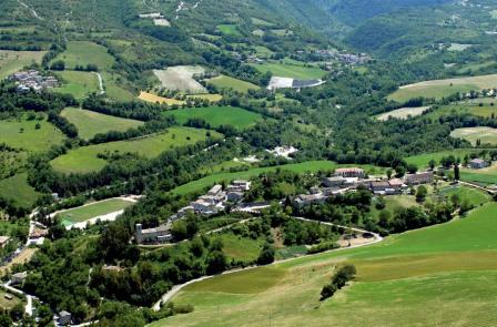
 And ‘it situated on a hill in the center of the valleys of Chienti and the slot. The villa was originally a hunting lodge. Around: a small church, a dependence-habitation for the gardener and other buildings modest. The park is planted with trees everywhere.
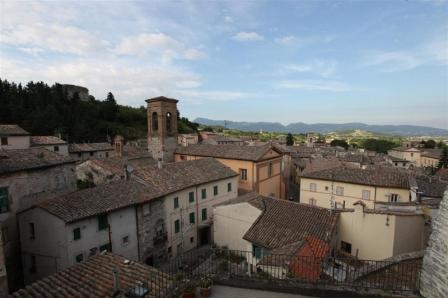

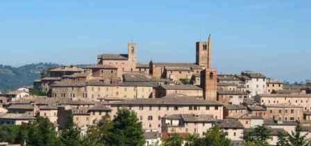
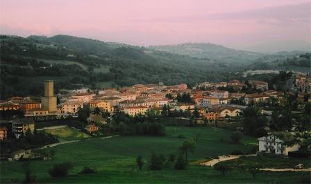
 Comune di Recanati
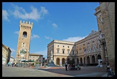
 ge of note is the “Valley of the Madonna”, it will go up by a road in the valley towards the little church of Our Lady at 721 m. share. It ‘was set up a “trail” to do exercises outdoors in a healthy environment. Interesting, near the church, some specimens adults dicarpino black.
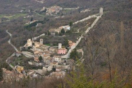
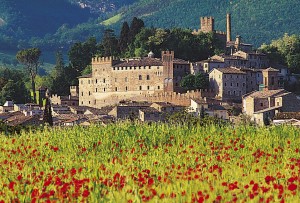
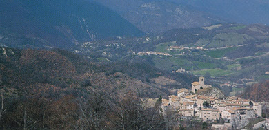
 Lanciano Castle was built in 1350-1418 and restored by the Da Varano at later dates. In 1621, he passed in rent to the Longing, then to the Rose in 1680, finally to Bandini who had as a fief by Pope Benedict XV. The interior is decorated in stucco, there are rooms for the collection of paintings, including portraits of famous women of the Da Varano. And ‘it surrounded by a large park. And ‘property of the Archbishop of Camerino.
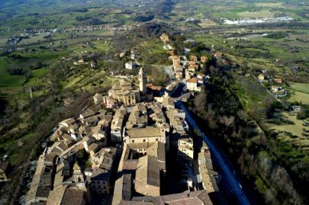
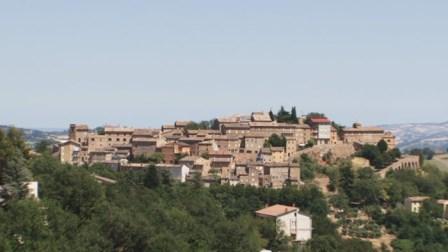
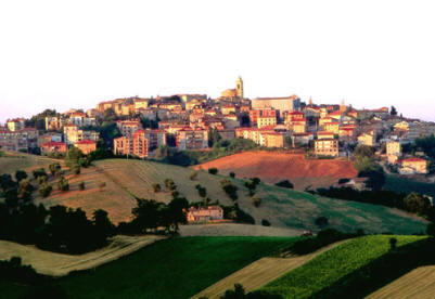
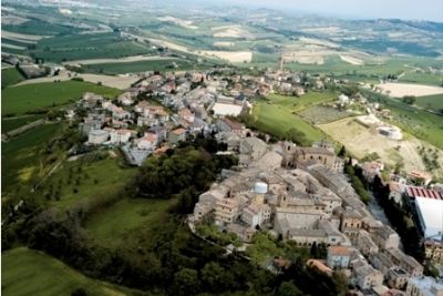
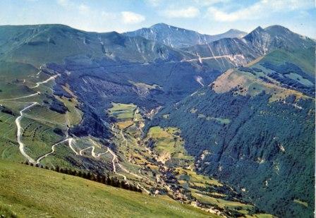
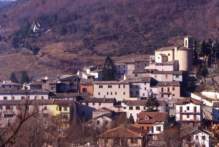
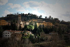 Camporotondo has great walls, magnificent palaces or great cathedrals; nevertheless, at certain times, in certain places of roads, see aprirtisi front of something unique, rare and magnificent: the snows of the Sibillini and the green fields of the valley of Fiastrone. Small town of Macerata, has had a troubled history, marked by moments of splendor and decay. It was the castle of Varano of Camerino of great importance for the defense of the territory from incursions of the City of San Gines.
 the direct rule of the Holy See. In 1860 it was annexed to the plebiscite, the Kingdom of Italy.
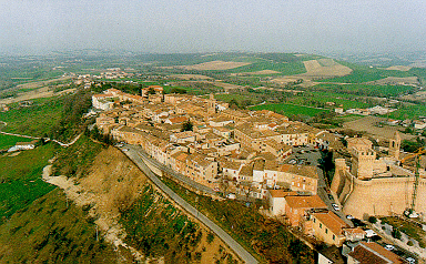 dieval village, shows a front of 1,004 mt. which they are readable all the features of the building with the stage and the auditorium. The monumental masonry parts bear witness to its former glory. It was built in the first quarter of the first century A.D. Excavations inside originate numerous statures scattered in various museums, among which is a copy of the famous in the rest of the Faun Passitele, recovered at the time of Pius IV (1777) and finished the Vatican Museums. The Roman amphitheater, returned to establish itself as admired container summer productions of texts of the ancient theater it is the only one of the Marche to the excellent state of preservation.
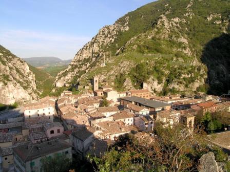
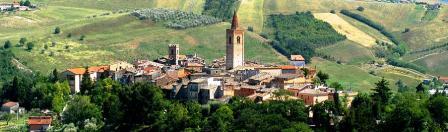
 Only at the beginning of ‘400 the country managed to gain independence sanctioned by Pope Eugene IV. The big boom came, however, in full ‘500 at the hands of the Counts Pallotta and in particular the Cardinal Evangelista, who became prefect of the building of St Peter’s under Pope Sixtus V, enlarged and embellished the family castle and transformed radically urban center that, from modest medieval castrum became a spacious Renaissance town. The direct subjection to the Church of the town of Caldarola lasted until 1799, when the papal rule was overthrown by the French Revolution.
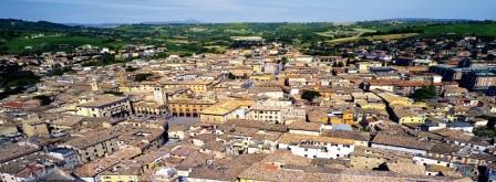
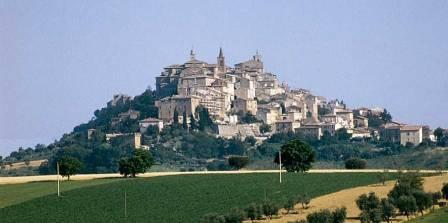 the Civic Museum and the Cathedral (XVIII sec.), One of the largest religious buildings in the region. Dedicated to the SS. Annunziata, was built to a design by Andrea Vici, a pupil of Vanvitelli, and houses several works of art including an altarpiece by Giacomo da Recanati. Under the beautiful square stands the wall of the arena, which opened in 1818 and later dedicated to ball player Charles Didim.
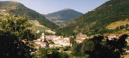
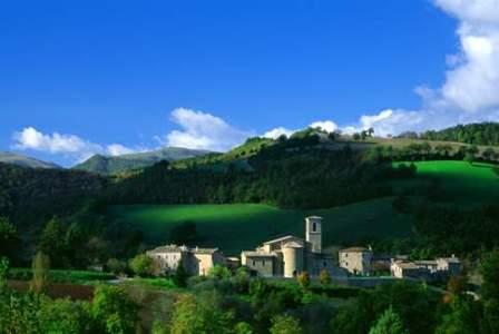 The name “Pievebovigliana” encompasses centuries of history: in the Middle Ages, probably in the Carolingian period, the first name you plebs Antep ancient bovellianum to indicate a sparsely populated area in which someone reported to settlements of Gallic origin, which became Roman and pagus Christian plebs. Gallic civilization, linked to the cult of the ox, also refers to the second part of the name, as well as the Roman land refers to times when the areas were bred horse. During the period of the lords, Pievebovigliana was tributary of the nearby powerful family of the Da Varano, so that its history is closely tied to the vicissitudes of the dukedom. Become a part of the Kingdom of Italy, after being under papal rule.
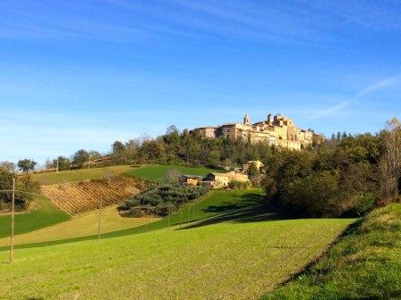
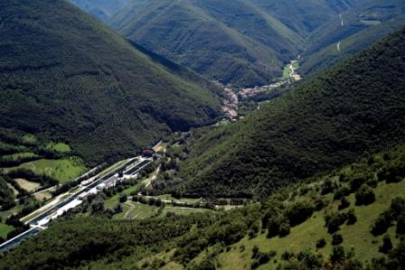
 chased by Hannibal after the battle of Trasimeno , by the Lombards of Spoleto and by Benedictine monks, the Franciscans and pilgrims of every age on the way to Loreto and Assisi. A discrete ground, shattered by armies of princes and dukes and calmed by the succession, with no way out, the sun and the moon. There are destinations like Pieve Torina, who are outside and not easily accessible. But it is as if they were inside, within every conscious traveler.
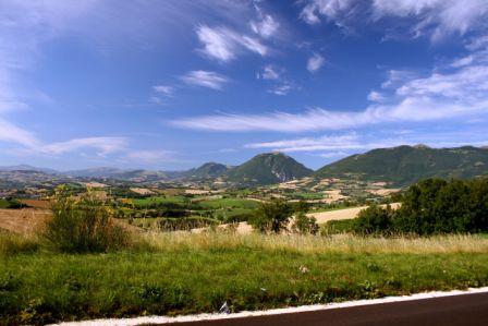
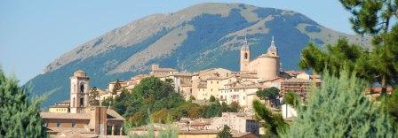
 HISTORY:
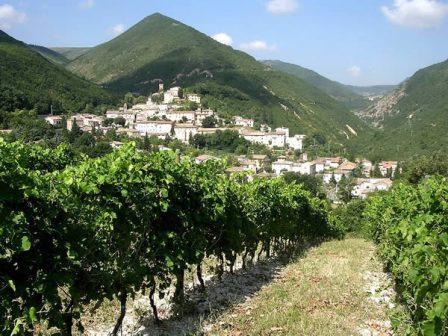
 of the seventeenth century, depicting the coronation of the Virgin and St. Urban I Pope with a majestic wooden frame carved and gilded. Keep a prestigious organ of Venetian Gaetano Callido, built in 1771. The sacristy, with wooden furniture of the ‘700, is home to a valuable collection called “Treasure of the Collegiate” and consists of paintings, busts of saints in silver, vestments and sacred.